Detail & Contour Solutions
Detail & topographic contour Survey Solutions
This type of survey shows all features found within the specified project area and scope. These may include, but is not limited to;
-
surface levels
-
trees
-
buildings
-
visible services
-
neighbouring dwellings within 1m from the boundary,
-
location and detail of all underground services (if accessible)
-
position of utility connections,
-
contour levels to Australian Height Datum,
-
original boundaries and dimensions.
-
property infrastructure & dwellings
-
installation of site control for ongoing solutions
Detail and topographic surveys provide the basis too all engineering & construction survey solutions.
Planning
Once the property/project area has been accurately surveyed, you will be provided with the necessary file format for submission to local authorities, engineers, architect, builder or draughts person for plan submission.
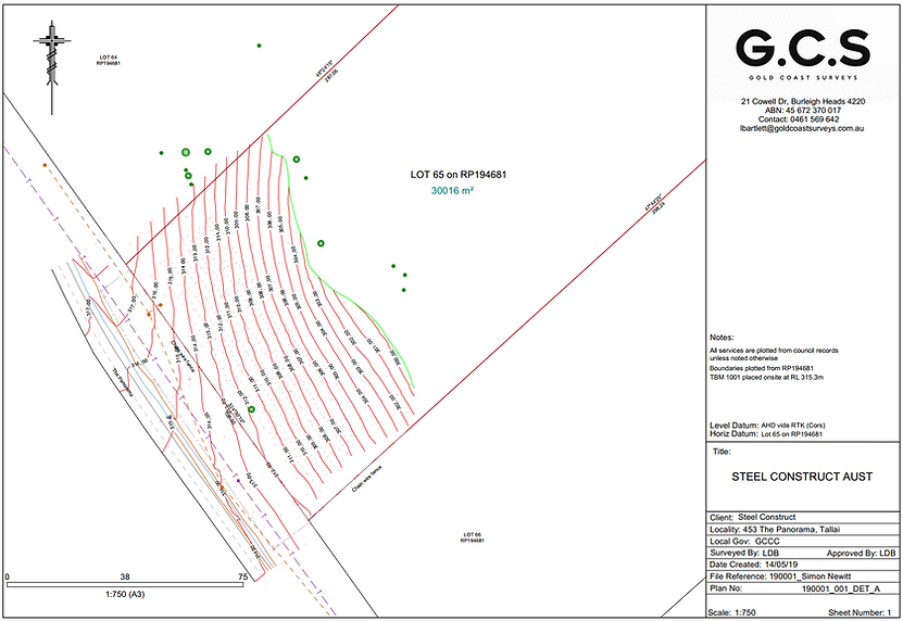
Topographic/feature contour survey example
Below is an example of a recent topographic/feature contour survey performed by a Gold Coast Surveys. All existing services, levels, fence lines and vegetation are articulated, providing your designer with all they need to expedient your project and gain approval from your local authority.
For more information or advice, please contact us today.